(Last updated on 13/10/2025)
This version of Senda del Peñón del Pez is an enjoyable walk starting and ending in Capilla, a small village in La Serena area of Badajoz province. During this circular route you’ll enjoy some fantastic views of Spain’s largest reservoir and beautiful hilly scenery from a rocky area at 734m over sea level. You’ll also have the chance to visit the local castle.
This article includes a general overview, practical information, and personal thoughts and tips to help you plan the Senda del Peñón del Pez walk when visiting Capilla.

This post contains affiliate links. If you click through and make a purchase, it will generate a small commission for me, at no extra cost for you. Read the full disclosure for more details.
Table of contents
Overview
The official PR-BA 52 Sendero del Peñón de Pez is a single-day (PR) FEXME-approved circular route starting and ending in Peñalsordo. According to FEXME, it is 11.3km long and it takes 3h 35min to complete.
What I did: after visiting Castillo de Capilla, I completed a partial, circular route starting and ending in Capilla. The walk was about 7.6km long and took approximately 3h (including a lunch break).
Start: Calle Carretera. Coordinates: lat. 38.82293, long. -5.08547.
Finish: Calle Carretera. Coordinates: lat. 38.82293, long. -5.08554.
Length: (approx.) 7.6km
Time: 3h
Difficulty: medium (3/5)
Senda del Peñón del Pez on a map
My thoughts on this route
I walked this version of Senda del Peñón del Pez in mid-February, on a rather mild day of gentle breeze, starting off at about 12.30pm, after visiting the local castle.
The first part of this route runs through the small village of Capilla along Calle Carretera, past the town hall (Ayuntamiento), following the signs for the castle. The path up to the castle starts off Calle Calvario, behind the church.


After visiting the castle, I joined the route again in Calle Calvario and continued, southbound, along Calle Pillar, which takes you to the outskirts past a little playing area with great views of La Serena reservoir.


Follow the paved road, still southbound, until you leave a house with a large rectangular fountain to your left, and you reach a diversion. Then take the track to the right, which starts climbing up amongst olive trees towards the sierra in front of you pretty soon.


Bear in mind that there are no signposts along this route. I recommend downloading and following this track.
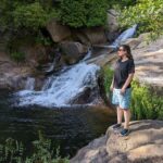
From this point onwards and until reaching a clearing, the climb can feel a bit hard on your legs, the terrain rugged and not easy to walk on, and you’ll be rather exposed to the sun and the wind. I stopped often, even if just briefly, to admire the view behind me.


Then you reach a rockrose-rich clearing, which marks the diversion, northbound, towards the highest point of the route – a triangulation station. I found the last stretch of this climb rather challenging and it got pretty windy and chilly near the top. The views are stunning, though, and worth the effort – particularly towards the west, with the village of Peñalsordo set against the surrounding sierra. The landscapes were particularly beautiful in mid-February after a rather rainy period.


The initial plan was to have lunch at the top, but it was way too windy and exposed, so we looked for a more sheltered spot under some trees instead.

After lunch, we walked back down to the clearing and joined the main track again, heading west towards Peñalsordo. The track becomes wider, qualifying as an unpaved road, I’d say, and zigzags a few times, before becoming a rather long (and thankfully rather flat) stretch.


Then you get off onto a track on your right and walk back to Capilla facing the castle. This part of the route is quite comfortable at first, but it’s deceiving; the last stretch goes up and down several times, which I found very tiring towards the end. The path runs next to the castle and leads you straight back to Calle Carretera.


Tips and practical info
When to do this route: Senda del Peñón del Pez is recommended for late autumn, winter, and spring. Late winter and early spring is generally my favourite time of the year for walks. I personally avoid walking in Extremadura during the summer months (mid-June to mid-September).
Before/after the walk: I recommend visiting the Castillo de Capilla before the walk. Park in Calle Carretera, walk up to the castle via Calle Calvario (behind Iglesia de Santiago), then back down to the village and join the walking route again on Calle Pilar.
Where to park: there is a free parking area on Calle Carretera on the northern end of Capilla, just past the little medical practice and the bus stop.
Where to stay: if you need a place to stay after completing this route, look for accommodation in Extremadura to find the most suitable place for your trip.
Other walks in La Serena:
- Sendero del Abrigo del Águila, in Magacela
- Senda de las Pozatas, in Castuera
This content is protected by copyright and belongs exclusively to Irene Corchado Resmella. To know exactly what this means, read the 'Copyright' section in the Website terms of use.
Irene Corchado Resmella
Hi! I’m Irene (/ee-REH-neh/). Long since settled in the UK, I explore my Spanish home region of Extremadura with an inquisitive mind, a sharp eye, and the duality that comes with being both a local and a visitor. Then I write about it here to help you discover this beautiful yet overlooked part of Spain. If you have any questions after reading this article, submit a comment below! Read more about me.